Alaskan Adventure 2010
To See our Route Click Here
We have been planning this trip for some time now, almost two years and now it’s time. So on Sunday May 23rd we left home for the beginning of our Alaskan Adventure. The first leg of the trip will take us to New Haven CT. where Kate’s fiancé, Ryan, will be graduating from Yale with his PhD in Musical Arts, on Monday. We arrived on Sunday to have dinner with Ryan, his sister Kiara, his mother Terri Anne, Kate, and Kiara partner Colleen. This is our first opportunity to met Ryan’s mom and we had a very nice evening getting to know everyone.
Monday’s graduation was very impressive, watching the pomp and traditions of this large ivy league university. After the graduation ceremony and Ryan’s hooding at Sprague Hall, we enjoyed a very nice lunch and walked back to Kate and Ryan’s apartment. At 3 PM, Kiara, Pat and I departed for Bradley Airport in Hartford to catch our flights. Kiara was flying back home to Detroit and Pat and I are heading for Las Vegas at 5:30 to pick up the truck and RV. If you are reading this out of sequence you will have missed the fact that we left the rig in storage back at the end of April at the Lake Mead RV Village, just south of Las Vegas. Frank and Sherry picked us up at the airport when we landed at 11:30 PM, and we checked into our hotel at Circus Circus. On Tuesday morning we arrived at the Lake Mead RV Village at around 11:30. We had planned to arrive earlier but we needed to return to the airport to pick up the luggage that US Air decided to leave behind in Philadelphia, the night before.
The RV’s and trucks were right where we had left them, 7 weeks ago, so we towed back the 200 yards to a site for a 1 evening stay. While Sherry and Pat got things ready in the RV and threw in a load of laundry, Frank and I returned the rental car, took my truck in for 4 new tires, and stopped by Von’s grocery store to pick up a few essential supplies to get us started and to restock the refrigerators. We had appointments on Wednesday morning at 8 to have tires installed on both RV, and at noon, with our wallets somewhat bruised we headed out of Vegas for our first night on the road, the Wal-Mart parking lot in Cedar City, UT. We completed our shopping to continue the stocking of provisions for our next few days on the road. Bright and early Thursday morning we took off up I15 to the “Loneliest Highway in America”, US 50 over to Ely, NV. What a beautiful and remote drive through the Utah and Nevada mountains. We spent the night at the Valley View RV park in Ely and on Friday morning we pulled out early heading for the Cactus Pete RV park at the casino of the same name in Jackpot, NV. We are just a mile from the Idaho border. This is memorial day weekend, so we had planned to get off the road early on Friday, make a short 185 mile trip to Meridian, ID, just a few miles outside of Boise, on Saturday morning and hold up here for 3 days until Tuesday morning, avoiding the potentially crazy holiday traffic. All went as planned, except for the 30 MPH, mileage killing, gale force headwinds we have had to endure for the past 3 days.
Our three day stay in Boise was very nice, except for a little rain and the lack of a picnic table at our site for a memorial day picnic. Of course it would be complete without at least a couple trips to Wal-Mart and a trip to Cabala's Sports for another pair of binoculars so we can each have a pair for what we hope will be many exciting wildlife sightings. Other than that we just relaxed and enjoyed sitting still.
On Tuesday morning June 1st at 9:30 AM we were on the road again. Heading for a 240 mile tow to Hermiston, OR where we will be staying at the Pioneer Village RV Park. This is a Passport America park, and will be the first park we will stay at since we joined. This was a gem of a park, and we would have stayed here longer, especially at the $18 / day PA rate, except we are getting anxious to get to British Columbia, because it just won't seem like we're really on our way to Alaska until we cross into Canada.
Wednesday takes us to the Carl Precht Memorial RV Park in Omak, WA. This park is run by the city and was another great find. We spent the afternoon, doing a load of laundry, going to the Safeway grocery store for a few more must haves before we cross the border tomorrow. We turn in early in anticipation of our 8:30 departure for Kamloops, BC.
Thursday morning bright and early we take off for the 40 mile drive to the border crossing at Oroville, WA. I'm leading today and when we get to the border Pat and I get in line, with two vehicles ahead of us with Frank and Sherry behind us. When it's our turn we pull up and hand the border guard our passports, answer a barrage of questions for what seemed like an hour, but most likely was really about 4 or 5 minutes, and we are waved through.
It turns out that Pat and I are the last vehicle before the border guard shift change and unfortunately, Frank failed to notice the red stop light and so he just followed behind us and pulled up to the guard station. This was the exact wrong thing to do because, the guard was not ready for him and he immediately started yelling at him about not waiting for the light to change to green. I guess because of this infraction the guard continued to be more than just a little irritated, and the questions came fast a furiously until the guard got what the wanted. He discovered that Frank and Sherry had the unmitigated audacity to try to bring a bag of apples into the country. He directed them to pull over into the penalty box area, a hockey analogy seems appropriate, and to dispose of their infectious fruit in the designated freezer. Meanwhile, Pat and I had pulled over into the Duty Free area waiting for them to catch up. After the poisonous products were disposed of, Frank decided they should now be free to go on their way, so he proceeded out of the parking lot without being instructed to do so. We now suspect there may be an all points bulletin, with a shoot on sight order, for the 2008 Cardinal RV with the PA plates. The remainder of the day was uneventful by comparison, with the words "WOW, that really beautiful", being uttered many times as we towed up and down the mountains, along the lakes and finally to the Kamloops RV Park in Kamloops BC. So we are now REALLY on our way, (even though we have already traveled about 1600 miles from Nevada just to get here). We have 20 days to go 2300 miles because we need to be in Anchorage on June 24th to pick up Erin and Jeanna, when they fly in to join us for a week.


Are We There Yet? NO, Keep Driving!!!
We left Kamloops early on Friday June 25th after a quiet evening. We are heading for Hixson BC about 290 miles away. There is a Passport America RV park there, and we want to use our new memberships. We pulled into the Kreekside RV Park at about 2:30. We are discovering that the RV parks are becoming more and more "rustic" as we proceed north, and this was surely the case in Hixson. This park does have full hook-ups however and the price is right at $15 per night. After a very restful night, this mountain air is great for sleeping, we pull out of Kreekside at 8:30 AM. Today's destination is Dawson Creek BC, which is Mile 0 of the Alaskan highway. We are starting to see more wildlife along the road and today we spotted moose, a black bear, and a large coyote. After our 290 mile tow we pulled into the Northern Lights RV Park at around 3 PM. We are going to take a little break here in Dawson Creek, so we will stay here for three nights, until Tuesday. We have been doing a lot of traveling over the past couple weeks and we need a little rest. Caravan season is beginning, there are two large caravans checking into this park and both have a departure date of Friday June 11th, we want to get out ahead of them so we aren't competing for RV sites all along the way. This seems to be a popular way to tour Alaska, and I guess if you want a worry free trip this would be the way to go. The caravan company takes care of planning all of your RV sites, as well as all the activities you will be doing along the way. Your job is to show up in Dawson Creek by a specific date and they do the rest. We on the other hand are more into doing it ourselves so on Sunday afternoon we sat down and made our reservations for our 3 day stay in Denali and our full day boat tour out of Seward. I stocked up on plenty of Dramamine before we left so I am hoping to be able to spend my time on deck with everyone else, looking at the wildlife and the glaciers and not in the bathroom throwing up. Those of you that know me know I don't do well on boats. The last thing we need to do is plan our shuttle trip while in Denali and we have several options from an 4, 6, 8 or 12 hour trip inside the park. These are basically school buses so we need to decide how much bouncing around our butts will be able to take.


Tuesday June 9, 2010 Alaskan Highway Mile 0 - 280
We departed Dawson Creek at around 10AM to start up the Alaskan Highway. Our goal was to drive to mile 175 and to stay in the parking lot of the Bucking Horse Lodge. The drive to the Bucking Horse was rather uneventful and the road was much like any of the other two lane roads we have driven on across Canada. I'm not quite sure what we expected, but all of the vehicles that were in the campground we just left that are traveling in the caravan, were being inspect to make sure they were road worthy for the highway as well as having rock guard screens installed to protect the headlights and grills. We reach the Buck around 2:30 and after having a cup of coffee we decided that the parking lot was much too dusty and actually it was really way to early to stop, so we decided to press on another hundred miles to Fort Nelson. We we got here we parked on a side access road and Frank went into a local well fitting business and asked if they knew of a place we could park for the night, and they invited us to use their parking lot, which is where we are now. I am bootlegging some local businesses internet access to do this update. In any case, maybe things are going to be getting worse as we progress north but the first 280 miles was not that intimidating. Of course there were the occasional frost heaved areas, bumps, washed out areas steep descents and assents but nothing really that severe. We did see two deer, a buck in velvet and another dead along the road, and we also spotted our first Caribou, also in velvet, grazing along the road. Tomorrow we move 150 miles north to Muncho Lake, BC. The travel books say it is "One of the most beautiful lake in the world." I'll let you know if it meets those expectations.
We departed Dawson Creek at around 10AM to start up the Alaskan Highway. Our goal was to drive to mile 175 and to stay in the parking lot of the Bucking Horse Lodge. The drive to the Bucking Horse was rather uneventful and the road was much like any of the other two lane roads we have driven on across Canada. I'm not quite sure what we expected, but all of the vehicles that were in the campground we just left that are traveling in the caravan, were being inspect to make sure they were road worthy for the highway as well as having rock guard screens installed to protect the headlights and grills. We reach the Buck around 2:30 and after having a cup of coffee we decided that the parking lot was much too dusty and actually it was really way to early to stop, so we decided to press on another hundred miles to Fort Nelson. We we got here we parked on a side access road and Frank went into a local well fitting business and asked if they knew of a place we could park for the night, and they invited us to use their parking lot, which is where we are now. I am bootlegging some local businesses internet access to do this update. In any case, maybe things are going to be getting worse as we progress north but the first 280 miles was not that intimidating. Of course there were the occasional frost heaved areas, bumps, washed out areas steep descents and assents but nothing really that severe. We did see two deer, a buck in velvet and another dead along the road, and we also spotted our first Caribou, also in velvet, grazing along the road. Tomorrow we move 150 miles north to Muncho Lake, BC. The travel books say it is "One of the most beautiful lake in the world." I'll let you know if it meets those expectations.
OMG Are We There Yet, Not Even Close 750 Miles To Go

Muncho Lake Provincial Park at milepost 456 was indeed a very beautiful place, but we decided to only stay one night because the second days weather look like it was going to be raining all day. We decided on a 8:30 AM departure so as Pat and I were getting things buttoned up and ready for the road I noticed that the battery in the RV was somewhat weak from running the furnace and water pump during the previous evening. I went out and hooked it to the truck to get a good charge so we could pull in the slides and raise the front end to hitch up. The charge on the battery didn't seem to be getting any stronger even after running the truck for 15 minutes, so we used what power we had left and pulled in the slides. Luckily there was enough "juice" to get the slides in and after some finagling and some help for the guy camping next door to us, we got hitched up. I was sure the battery had just bit the dust and that I would be paying a visit to Wal-Mart in a couple days, once we get to Whitehorse, for a new one, until then we would need to find campgrounds that offered electric service. Our next stop is going to be Watson Lake in the Yukon Territory.
Watson Lake YT and the Signpost Forest - Milepost 635

The 170 mile drive to Watson Lake was somewhat uneventful. We did spot a few Wood Bison and a Caribou along the way but other than that it was just one spectacular scenic view after another. I think we are starting the become spoiled with all the natural beauty and vastness of the landscape as we travel mile after mile. Around every corner is another beautiful aqua blue stream, snow capped mountain view or scene of a distant mountain chain and of course we are always on the lookout for moose, caribou, bears, bison, eagles or anything else that moves for that matter. We pulled into the Downtown RV Park in Watson lake around 2 PM, the park is just a short walk to the famous Sign Post Forest so we make a plan to do that after dinner. Since it stays light here until well after 10 PM there is not need to rush. After getting settled in our site and connecting the RV up to the electric service I took a look at the control panel in the rig and noticed the battery was charging as it should. This was rather curious since it wouldn't take a charge while hooked to the truck. To make a long troubleshooting event short, I discovered that there was no 12V power at the plug on the truck side. I decided to check the fuse box to make sure we hadn't blown a fuse. The fuses were all intact, I ended up speaking to a technician at the Chevy dealership in Whitehorse on the phone and he suggested I make an appointment to bring it in for service. He indicated they had seen this problem many times before and that the fix would be a quick one, so I made the appointment for 8AM Saturday morning. Since it was only Thursday we would have the next day to make the 270 mile drive to Whitehorse.
Whitehorse - Milepost 911
We arrived at the Pioneer RV Park in Whitehorse around 3PM after a long day. On the way as we were driving, I noticed something in in the road about 1/4 mile away. As we approached Pat suggested I slow down in case it was something we wanted to take a picture of. As we crested the rise in the hill, we saw a young Grizzly Bear sitting right in the middle of the road. Now this would have been cute if it wasn't a Grizzly Bear, because I don't think you can classify them as cute at any stage of their life. Notice the claws on his front paws in the third photo, they're terrifying, click the photo to enlarge.


The appointment to have the truck fixed was bright and early, 8 AM, Saturday morning at Klondike Motors in Whitehorse. Klondike is the local Chevy, GMC dealer in this part of the Yukon. When I spoke to the service technician on Thursday he told me he had seen the problem before and sure enough he knew exactly what was wrong. About 10 minutes after he pulled the truck into the service bay he came out to the waiting room to get me. He took me back into the shop and showed me a wire that he had pulled out of the bundle that wasn't connected to the fuse box. He explained that Chevy never hooks up the wire for the 12V going to the rear trailer connection. It is up to the dealer to make this connection and my dealer had failed to do so. He sent me back to the waiting room, while he made the connection to the fuse panel and in another 10 minutes I was on my way with my wallet $70 lighter than when I arrived. All this time I had thought that the truck was charging the battery in the RV, but that hasn't been the case. We have just been lucky that the battery has held up on those nights in the Wal-Mart parking lots, and the other dry camping locations over the past three years.
On Saturday afternoon we decided to take a hike through Miles Canyon along the Yukon River. It as a beautiful sunny day, a little cool, but a perfect day for a hike. The canyon was indeed gorgeous and we enjoyed the afternoon. On Saturday evening we had tickets for the Frantic Follies Review, a vaudeville show put on at the local hotel in downtown Whitehorse. The show was hilarious and there are many talented people here in this remote corner of the world. Sunday was spent just laying low, we went downtown Whitehorse to browse through the stores to see if there was anything Sherry and Pat couldn't live another day without, nothing was found. We also drove over to the dam, just a couple miles out of town, we checked out what is claimed to be the worlds longest wooden fish ladder. It was quite cool but the fish haven't arrived yet. They are just now entering the Yukon river and starting their 2000 mile swim, they should be here when we return in mid July.
On Saturday afternoon we decided to take a hike through Miles Canyon along the Yukon River. It as a beautiful sunny day, a little cool, but a perfect day for a hike. The canyon was indeed gorgeous and we enjoyed the afternoon. On Saturday evening we had tickets for the Frantic Follies Review, a vaudeville show put on at the local hotel in downtown Whitehorse. The show was hilarious and there are many talented people here in this remote corner of the world. Sunday was spent just laying low, we went downtown Whitehorse to browse through the stores to see if there was anything Sherry and Pat couldn't live another day without, nothing was found. We also drove over to the dam, just a couple miles out of town, we checked out what is claimed to be the worlds longest wooden fish ladder. It was quite cool but the fish haven't arrived yet. They are just now entering the Yukon river and starting their 2000 mile swim, they should be here when we return in mid July.


Kluane National Park

Congdon Creek Campground Near Destruction Bay, YT
We decided to spend another couple days dry camping in one of the many National parks we are passing through. The only thing we are unsure about is which of these campgrounds we are able to fit into, so I have been relying on the RV Park Review website. This site provides reviews of people that have go to these parks, and most of them tell you what kind of rig they have, so I know if they could fit we can fit. This was a really nice park situated directly on Kluane Lake and our site overlooked the beach. The park offered free firewood so we took advantage of this amenity and kept a fire burning for the better part of our two day stay. We also used the fire one evening to roast our hot dogs, they were great. The rest of the time was spent taking walks, reading and just goofing around.
We decided to spend another couple days dry camping in one of the many National parks we are passing through. The only thing we are unsure about is which of these campgrounds we are able to fit into, so I have been relying on the RV Park Review website. This site provides reviews of people that have go to these parks, and most of them tell you what kind of rig they have, so I know if they could fit we can fit. This was a really nice park situated directly on Kluane Lake and our site overlooked the beach. The park offered free firewood so we took advantage of this amenity and kept a fire burning for the better part of our two day stay. We also used the fire one evening to roast our hot dogs, they were great. The rest of the time was spent taking walks, reading and just goofing around.
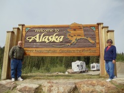
Finally We Are There - ALASKA

On Tuesday morning June 15th we depart Destruction bay around 8:30. Today is the day, we will be crossing the border into Alaska. The road between Destruction Bay, YT and Tok Alaska is absolutely awful. This area is cursed with permafrost, which means that a few feet below the surface the ground never thaws. The problem this causes is that water on the surface remains on the surface. It can never be absorbed so this water repeatedly freezes and thaws and just wreaks havoc with the roads. Honestly there were several miles where the road was gravel and this stretch of road was in much better shape than the paved section.
Tok, Glennallen and Valdez

Tok is truly the gateway to Alaska, you just can’t get into or leave Alaska by land without going through Tok. So you would think it would be a fairly large bustling place. Well you would be wrong. Tok is a tiny little community about one mile long on the Alaskan highway. There is one very small grocery store, an Alaska tourist information center, several souvenir shops, 3 gas stations about 4 RV parks and a couple motels.
We chose to stay at the Tundra RV Park for two nights. This was a very nice park. The reason we stayed there is because the Alaska Camping book that we have says they don’t get much business because they were at the north end of town and everyone makes there selection before they got there. So being the kind of people that roots for the underdog, we decided to drive the extra ½ mile and were glad we did. The park was clean, well maintained and well treed with free firewood for an evening camp fire. The owners were and older couple that had moved to Tok from Montana 20 plus years ago. We asked him about the cold winters and he related a few stories about square tires and the need to drive a couple miles in reverse because that’s the gear he left his truck in when he parked it and the transmission fluid was just too thick to allow him to shift it into any other gear. The coldest he had seen it was 74 degrees below zero, brrr.
While in Tok we visited just about every business available, the grocery for a loaf of bread, both of the souvenir shops, the information center and we filled up at the station that offered a free car and RV was with a fill-up. Everything was covered with mud from the gravel portions and the construction areas of the highway. We didn’t know it yet but we would be seeing plenty more mud and gravel as we travel the highways of Alaska, but I getting ahead of myself.
On Thursday morning June 17 we departed Tok for Glennallen. This is a big departure from the traditional way people seem to see Alaska. All the caravans that I have look at and most of the people that we talk to seem to go around Alaska counter clockwise, visiting Fairbanks first and then proceeding around the circle to Danali and then Anchorage. But we need to be in Anchorage on June 23rd so Frank and Sherry can pick up their daughters Erin and Jeanna who will be joining them for 10 days, so we will depart from the norm.
While on the way to Glennallen we spot a moose about chest deep in a pond dipping his head to enjoy the vegetation growing on the bottom. We selected the Northern Nights RV park in Glennallen, not for any particular reason, but it was a good choice with all the amenities that we would need. From here we take day trip down the Richardson Highway to Valdez to see the end of the famous Alaska Pipeline and the sight of the also famous Exxon Valdez oil spill. On the way we stopped at a bridge that crosses a river to watch some people fishing for salmon, we saw several of them being caught.
While in Valdez we toured two museum’s which gave the history of the area including the relocation of the town after the devastating 1964 earthquake, we learned a bit about the March 24th, 1989 oil spill and I’m happy to report that we weren’t able to spot any evidence of the disaster. We also learned about the gold miners that came here in 1898 and started their trek to the gold fields by hiking up and across the Valdez glacier.
"Gold in Alaska!" "Valdez Glacier — Best Trail!" So rang the headlines in 1897-1898.
Steamship companies promoted the Valdez Glacier Trail, praising it as the only All-American trail to Alaska's interior. The Copper River, they said, was on American soil. Prospectors were bound to find even more gold there than in the Klondike.
It was one of the greatest hoaxes in Alaska's history. The prospectors arrived to find a glacier trail twice as long and steep as reported. With frontier grit, they set about hand sledding more than a 1000 pounds of supplies over the glacier, building boats, rafting the Klutina River's Hell's Gate rapids, and prospecting unnamed creeks.
By August most of the 4,000 or more goldrushers knew — they had been conned. But was it worth it? No, for those who died. Yes, for the many who found the greatest adventure of their lives. They returned home to tell others about Valdez's mountainous beauty and awe-inspiring glaciers. They told stories of their thrilling experiences rafting wild rivers, encountering bears, catching fish and hiking wilderness trails. And yes, for those who succumbed to the lure and challenge of building the first ice-free trail between coastal and interior Alaska.
Today, this is the route of the Richardson Highway and the Trans-Alaska Pipeline from Prudhoe Bay to Valdez. And yes, again, for those who were so intrigued by this majestic wonderland they stayed to build the town of Valdez and Alaska.
—Nancy Lethcoe
We walked around the docks looking at the hundreds of boats docked there and examined the leader board reporting the current standings in the Halibut catching contest. All in all the trip to Valdez was quite beautiful with several waterfall lining the canyon road leading to and from the town.
Anchorage 6/20 - 6/22
On the morning of June 20 we packed up to begin our trek to the interior of Alaska, we will be driving the Glen Highway from Glennallen to Anchorage, about 180 miles. The scenery along the route is quite beautiful and although they call this Interstate 1 it’s really just another two lane road like so many others we have been on. Along the way we spot a mother black bear and her cubs and we paused for a break at Sheep Mountain to see if we could spot any sheep licking the mineral deposits they are fond of on the cliff thus giving the mountain its name. We pull into the Fort Richardson RV park just off the Army Post. This will be our base for the next three days while we see the sights of Anchorage.
On June 21st we decide to take a tour of the Alaskan Native Heritage Museum. This is a great museum, giving you an impressive sense of the great diversity of the people and tribes of Alaska. There are literally a dozen or more distinct “peoples” that inhabit this 663,267 square mile expanse of land and water, all of them with their own dress, dances, and customs. Of course growing up we all knew about the Eskimos’ of Alaska but there are so many more distinct cultures and customs to the Native Alaskans. I would highly recommend the museum if you ever travel to Anchorage.
Just a little about the size of Alaska. The state is over 12 times larger than the state of New York and 425 times the size of Rhode Island.
June 22nd takes us to the Anchorage Zoo, since we saw the peoples of Alaska yesterday we decide to see the animals of Alaska today. It’s a really nice day, temps are in the 70’s and it’s a great day to walk around the zoo.
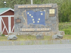
Seward
On June 23rd we head for Seward. We will be driving the 130 mile Seward Highway, aptly named as it is the only route between Anchorage and Seward. What a beautiful drive. The first half is along the coast and we see several bald eagles just resting on the tidal flats. On the remainder of the road there are numerous signs and road closing gates warning of avalanche areas, a fate we don’t need to worry about during this season of the year, but alert you to what the conditions must be like during the long winter.
Seward is not a very big place, with a surprisingly small population of just a mere 2830. While there we will be staying at the Army Resort and RV Park. After getting settled in and after dinner we decide to explore and get the lay of the land with a little drive along the waterfront and see what else Seward has to offer. While on our evening excursion we spot several sea otters, playing and eating near the shore as well as a couple harbor seals. After we return from our drive Pat spotted a pair of bald eagles soaring along the cliff just past the RV. We will be here in Seward for three activity packed days.
On June 24th we head off for a hike to the Exit Glacier. The history according to Wikipedia is:
“In the spring of 1968, the first documented mountaineering party succeeded in crossing the Harding Icefield. Ten people were involved in the crossing, which went from Chernof Glacier east to Resurrection Glacier (Later renamed Exit as the newspaper reported that the group would be descending the "Exit Glacier").”
Also of interest and according to Wikipedia:
“The Exit Glacier is especially notable for being a drive up glacier. A spur road of the Seward Highway takes visitors to the only road accessible portion of the Kenai Fjords National Park and a number of hiking trails that take visitors to the terminus of the glacier or even up to the Harding Icefield itself. Although one of the Harding Icefield's smaller glaciers, because of its easy accessibility and abundant hiking trails around and above the glacier, the Exit Glacier is one of the most visited glaciers in Alaska. Exit Glacier is open year-round. Upon the arrival of snow, usually in mid-November, the road is closed to cars but open to a wide-range of winter recreation –from snow machines to dogsleds and cross-country skiers.”
On Friday June 25th Frank and Sherry travel back up to Anchorage to pick up their daughters Erin and Jeanna, who are flying in for a 10 days visit. While they spend the day in the truck and at the Anchorage airport, Pat and I spend the day at the Sea Life Museum here in Seward.
June 26th is a drizzly and somewhat dreary day and the day we have reservations for the highlight of our Seward excursion. Today we will be taking an 8 hour boat cruise to the Holgate Glacier. Of course this day arrives with me feeling a bit of anxiety. Anyone that knows me knows that moving vehicles and I are not on the best of terms and boats and I are especially not fond of one another. As a matter of fact I would go so far as to say “I hate boats”, hate is actually not a strong enough word to describe my utter loathing for the vehicle. Of course it because just about every time I have been on a boat I have gotten deathly sea sick. And a boat on the water has a way of moving in every direction at once, up, down, left and right, in varying degrees, constant motion reeking havoc on my inner ear. To me it’s like hitting your thumb with a hammer, after you do it once you just know you don’t want to do it again. But a trip to Alaska without a cruse through the Kenai Fjords wouldn’t be much of a trip at all, and certainly wouldn’t be complete. So for three days I have been taking Dramamine trying to get ahead of it, preparing my body for, what experience has proven to me to be a, truly awful and the worst experiences of my life, sea sickness. I’m prepared to have a really bad time. Of course, I can’t stand the thought of standing on the dock waving good bye to Pat and the others. And especially to hear the stories they will return to tell me, of how they saw a dozen or more Sea Otters, Harbor Seals, a breaching Humpback Whale with her calf, a lone Orca, flocks of Horned and Tufted Puffins, Dall’s Porpoise playing in the wake of the boat, rafts of Stellar Sea Lions, Bald Eagles, and thousands of nesting birds along the rocks. As well as the glaciers of the Harding ice fields, with the Holgate Glacier calving into the sea as they listened and watched from the boat, and how during the trip back, the 8 foot seas would toss the boat around like a toy, while crashing through the waves, with the spray off the ocean splashing over the bow. I knew I had to take the risk, to see it all for myself, and it was spectacular.
Wasilla - Telkeetna - The Mountain

On Sunday morning June 27th we departed Seward for our trip back up the Seward highway, passing back through Anchorage, to our destination for the next three days, Wasilla. Of course nobody, including us, had ever heard of Wasilla, population 5,469, before Sarah Palin came on the scene in the presidential election of 2008.
On June 28th and 29th, while Erin and Jeanna are here, we decide to split up, since we all won’t fit in one vehicle anyway, and spend some time exploring on our own. Pat and I will take a 4 mile round trip hike today, as we drive up and over Hatcher Pass. This drive is described as follows:
“For a beautiful drive on some of the highest, most spectacular, and wildest roadway in the state, take a detour up Palmer-Fishhook Road (Hatcher Pass Road). After about 13 miles of modern pavement, you'll negotiate some rough conditions up and over the mountains-peaking at Hatcher Pass (3,886 feet). This old mining area is scenic, rich in history, and offers great hiking and berry picking. Hatcher Pass Road is 49 miles total and continues east to the Parks Highway (mile 71.2), near Willow.”
Well, the day Pat and I drove over the pass, the clouds were so low we could barely see the hood of the truck, as we negotiated our way along the steep and often one lane dirt road. But, as we descended the opposite side of the mountain, the sky cleared and you could see virtually forever. When we reached Willow and the junction of the Hatcher Pass Road and the Parks Highway, we looked north at a perfectly blue sky and decided to take the 40 mile trip to Talkeetna to see if we can get a glimpse of 20, 320 foot Mount McKinley. Our efforts would be rewarded with what turns out to be a very rare sighting of the mountain. It turns out that only about 20% of the people that travel to Alaska get to see “Denali”, Mt. McKinley. It turns out she is quite shy and I will expound upon this fact later, when I describe our adventures in Denali National Park, so read on.
Of course, a trip to Wasilla now days, wouldn’t be complete without trying to get a peek at Sarah’s house, which turns out to be quite easy to accomplish.
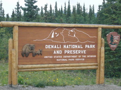
6/30 - 7/2 Danali National Park
On Wednesday June 30th we depart Wasilla for the 193 mile drive north, up the Parks Highway, for our three nights stay at the Riley Creek Campground in Denali National Park. Shortly after arriving and getting things set up we head for the shuttle bus that will take us to the park headquarters and the kennels where we will see a dog sled demonstration. We get to meet the dogs, get a look at the sleds, learn about the history and importance of keeping these animals and this form of transportation, which is still used today to get around the park during the winter. We were also treated to a demonstration of these dogs doing, what it is obvious they love to do, pull a sled. Even on dry ground they had no trouble pulling a sled with a musher around an oval course.
July 1st, we have a reservation on the 1 PM shuttle bus which will take us to the Eielson Visitor Center. This is an 8 hour round trip journey into the heart of the park. We have opted for the shuttle rather than the tour bus at the advice of the woman at the reservation office. On the tour bus you get a box lunch, a constant narration of the history of the park and the geology etc. of the landscape you are driving past. On the shuttle bus, the driver just drives, and point out specific points of interest, stops to observe any animals we happen to spot along the route, stops for the same bio breaks as the tour bus, and you have to bring your own lunch. The woman at the reservation office told us the cost difference is about $100 a person, and “you don’t need to listen to someone yammering at you the entire time.” The reason you need to take the shuttle bus is because private vehicles are only allowed to drive 15 miles into the park, to the Savage River Bridge. At that point you encounter a guard shack that only lets the shuttle and tour buses past. The Eielson Visitors Center is at mile 66 of a mostly single lane dirt road, that at many points is barely clinging to the side of a 400 – 500 foot sheer drop off. There were a few times that we were all biting our nails wondering if we were actually going to make it past the oncoming buses returning from the earlier departures that day. Along the way we stop to observe several Caribou, Grizzlies, and we get to see the mountain on and off throughout the day. Seeing the mountain doesn’t seem like a big deal until you hear that only 20% of the visitors to Denali National Park actually get to see it. One of our shuttle bus drives told us she was working in the park for 45 days before she got her first look at the mountain, so we were very fortunate to have seen it twice.
On July 2nd, Frank and Sherry needed to run Erin and Jeanna back to Anchorage for their return flight home and Pat and I decided to take an easy hike on the Savage River Loop Trail. We walked to the Denali Wilderness Access Center to catch the shuttle bus that will take us to the trail head at mile 15 of the park access road. This is a really easy loop hike traveling a mile down one side of the Savage River, crossing a foot bridge and coming back up the otherside. While on the trail we spot several marmots, dozens of arctic ground squirrels, and a bunch of Ptarmigan, arctic chickens, some with clutches of chicks. It was a beautiful crisp summer day.
Clear AK 7/3 - 7/4
Yesterday, we naively tried to extend our stay in Denali but of course this being the 4th of July weekend there was not way there were any vacant sites available. So on the morning of July the 3rd we head out for a very easy 49 mile drive to Clear Alaska. Near the town of Clear there is an air force radar station where Frank was stationed back in the 80, this is one of the stops he had been wanting to make as we make our way around the loop. Of course Pat and I have no objection, because we don’t have anywhere else to be. We decide to go to the Clear Lodge for dinner, the only local hangout in Clear and Frank is somewhat surprised that it is still there. The “town” of Clear is really just a crossroad on the park highway with a population of 216. We decide to stay at the Tatlanika Campground which is directly on the Nenana River about 5 miles south of Clear. We are going to hold up here and just relax for a couple days during the holiday weekend and not attempt to move up to Fairbanks. We took a day trip up to the town of Nenana and spotted a moose feeding in a marsh area along the road, but other than that we did some laundry and just laid low.
Fairbanks and Beyond 7/5 - 7/11
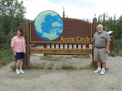
On Monday July 5th we pack up and move a short 95 miles up the road to Santa Land RV Park in North Pole, AK. This park is about 15 miles from downtown Fairbanks and we will be spending an entire week here. We have been on the move for weeks and we are looking forward to just staying put for a little while. Actually, this just means we won’t be hitching up and towing anywhere it doesn’t mean we are just going to sit around and do nothing. On Tuesday Frank and Sherry decide to go down to spend the day at the Eielson Air Force Base, just down the road from the North Pole. Pat and I spent a relaxing morning just doing nothing and about 2 PM we decide to take a nice leisurely 200 mile drive up to the Dalton Highway and then on to the Arctic Circle. Actually when we left we were only going up to the Dalton so we could say we drove the same road as the Ice Road Truckers drive, but along the way we made the decision to continue on to the Arctic Circle. Leaving at 2 PM really isn’t a problem because we are so far north now that it never gets dark. This is a 12 hour round trip tour and we get back to the RV around 2:30 AM.
On July the 7th, we head out to the Fairbanks Farmers Market and take a tour of the Pioneer Park Museum.
On the 8th, we have reservations to tour the El Dorado Gold Mine, complete with a train ride through the mine and panning for gold at the end of the tour. We all find gold, we think they actually seed the pouches of dirt they give us, and Pat and Sherry sucker Frank and I into buying the locket necklace to display our finds. Of course Frank and I are sure the gift shop is the biggest gold mine on the property.
July 9th is laundry day and just a day to relax. On the evening of July 10th Pat and I decide to attend a show on the Aurora Borealis at the Lacey Street Theater in Fairbanks. This show is a panoramic slide show of the Aurora set to music. Since we are here in Alaska in the summer, there is no opportunity for us to see the aurora, because it never get’s dark. The show was great especially since Pat and I were the only two people in the theater. After the slide presentation the creator of the show came out and spent a half hour telling us how he produced the program and selected the musical accompaniment.
While riding around Fairbanks the past few days we saw signs for an Native Alaskan and Native American Pow-Wow. So on Sunday July 11th we drive to the field where the pow-wow is taking place. There were many different native groups in attendance performing their traditional songs and dances, all dressed in their native garb. They were also booths where they were selling native foods and crafts. At the end of the ceremonies’ they released a bald eagle that had been injured and rehabilitated. It was an amazing ceremony. We will be departing Fairbanks tomorrow so after the Pow-Wow we stopped at Wal-mart to restock the RV for our trip back across Canada.
Finishing the Alaska Highway
On Monday July 12th we finish packing up after our week in Fairbanks and head down the road for Delta Junction, AK. Delta Junction is actually where the “Alaska Highway” officially ends. Today we will actually be completing the last 107 miles of the Alaska Highway, however we’ll be doing it backwards heading back to Tok. As I mentioned earlier in the blog we veered off the Alaska Highway taking the Glen Highway over to Anchorage. We pulled back into the Tundra Lodge RV Park in Tok around 3. Our plan is to head up the Taylor Highway from Tok, through Chicken AK and then across the Top of the World Highway and ferry over the Yukon River and on to Dawson City, YT where we will spend a couple days. Then continue on down to Whitehorse. We planned this route so we will do as little back tracking as possible because sadly, once we leave Tok we will actually be on our way back. Well as I said this was the plan and like most plans things sometimes need to change. When we reach Tok we find out that a portion of the Taylor Highway has been washed out. It turns out there was a massive rain storm dumping over 4 inches of rain in the area. The current report is the road may be repaired within the next couple days. We decided to stay put for a couple days to see if the road report improves. On Tuesday we decide to take a drive up the Taylor, passed the “Road Closed Signs” and on up to Chicken or as far as we can get. It turns out the road is actually open all the way to Chicken, except for about a 50 yard section where the road has washed out, except for the efforts of a lone front end loader operator who’s job it is to fill the road back in with rocks should it wash out again. While in Chicken we find out for the local people, who are actually in the know that the Top of the World Highway, beyond Chicken, has been washed out for several miles. There are a dozen or so stranded RV’er on the road with washouts both in front and behind them. The focus of the highway crew is to create a passable single lane to get these people off the highway. The prognosis is that the road won’t be open again for traffic for months because some of the washouts are miles long. We spent the afternoon exploring the gift shops, enjoying a piece of pie at a local diner in Chicken before we head on back to Tok.
We Make the Turn For Home
On Wednesday morning July 14 we pull up stakes once again and hit the road. We have made the decision to scrap our plan to tow the Top of the World Highway to Dawson City, YT. We phoned the state police and asked if they felt the road would be open any time soon and they confirmed the report that it may be weeks before that would happen. We are a little dismayed because this means we will be back tracking about 640 miles. Had we been able to follow our original plan we would only have needed to travel about 250 miles of the same road we traveled on the way up. This also rings true the fact that we are now starting the return trip home. Although it will still be over a month before we plan to get back to Rochester, we are finding it hard to believe that the Alaska portion of our trip is over. We decide to spend the night along the road on Kluane Lake east of Destruction Bay. The weather has turned cold and rainy, so we snuggle in for the night. The next morning the weather hadn’t improved much as we pull out for out next stop back to the Pioneer RV park in Whitehorse.
At the Pioneer RV Park in Whitehorse, we decide to try the upper more wooded part of the camp ground, this is quite a stark contrast to the pull through sites in the lower part of the campground, which is not much more that a long parking lot with RV hookups. It is quite a steep pull up to the upper campground, but the sites are wide and well treed and very pleasant. We are planning to be here for 3 nights. On July 15th we take a trip over back over to the fish ladder, here in Whitehorse. When we were here last we were told the Chinook salmon usually show up toward the end of July or in early August, we know we are still a little early to see these fish that travel nearly 2000 miles from the Bering Sea, the entire length of the Yukon river. We have been hearing all along the way that the salmon are late this year. Nobody know why but for some reason all the species are running behind schedule and the Chinook are no exception, they just aren’t here yet. We see a few Arctic Grayling making their way up the ladder but no salmon.
One of the things we want to do while we are here in Whitehorse is to take a ride on the White Pass Railroad, so on Friday July 16th to board a bus that will take us to Fraser BC where we will board the train for Skagway. The train climbs up to the 2865 ft. White Pass Summit goes through two mountain tunnels crosses several steel and wooden railroad trestles and then descends down the mountain to sea level at Skagway. The train clings, barely, to the side of a steep ravine and below us and along the way we see the route taken by the stampeders during the Klondike gold rush, which began in 1897. The scenery is quite stunning and we really enjoyed the trip. As for Skagway itself, it’s a tourist mecca with dozens of restaurants and gift shops selling everything from gold and art to typical junk you would find in any tourist area. Skagway is one of the ports of call for the Alaskan Cruse ships as they make their way from Seattle and Vancouver to Alaska and back again. We then re-board the bus for the trip back to Whitehorse.
The Stewart - Cassiar Highway

On Saturday July 17th we pull out of Whitehorse for our last 250 miles of back tracking down the Alaska Highway. The plan is to hook up with the Cassiar Highway and head south for Hyder Alaska. It’s a long day of driving over 300 miles and we stop along the road at a rest area for the night. Some other tourists during our trip have cautioned us about taking the Cassiar Highway, they tell stories of very steep grades, narrow winding areas and generally bad road conditions. Being concerned about these warnings, I have asked several people of authority at the visitor centers along the way about the condition of the road and if it is a recommended travel route and they have assured me that it is. So we are a little concerned as we make our way south. The road is somewhat narrow but generally this first 50 miles of the 400 mile highway haven’t been anything to cause us great concern.
Day two on the Cassier proves to be fairly uneventful. The scenery is spectacular, this is one of the most scenic roads we have traveled. We check out every pond and lake we pass for signs of moose but we haven't seen any, there is a lot of evidence of bear in the area though just by birtue of the quantity of scat on the road. We pull into a rest area along the shores of Mehan Lakes. The view is amazing, so are the mosquitoes.
Day two on the Cassier proves to be fairly uneventful. The scenery is spectacular, this is one of the most scenic roads we have traveled. We check out every pond and lake we pass for signs of moose but we haven't seen any, there is a lot of evidence of bear in the area though just by birtue of the quantity of scat on the road. We pull into a rest area along the shores of Mehan Lakes. The view is amazing, so are the mosquitoes.
July 19 puts us back on the Cassiar highway after a quite night at the rest area. Today we will arrive in Hyder, AK our destination for the next few days. The reason we are going to Hyder is to see the bears. There is a viewing platform, built by the parks service, where we will be able to watch the grizzly bears fishing for salmon.
Around noon we take a turn off the Cassier onto the Glacier Highway for the final 50 miles of the day. This highway has some of the most spectacular views we have seen. You would think by now we would be tired of looking at the scenery, but not so. The Glacier highway proceeds down a canyon between two mountain ranges with views of the Bear Glacier, and dozens of waterfalls. All as you drive beside a raging river, it’s a great ride. We pull into Camp Run A Muck, our camp ground in Hyder. Hyder is basically a ghost town, there are a couple BAR / restaurants, as well as a couple churches where I guess you go to repent what you did in the bars, a general store, a gun shop and a campground. After we get things set up we head on out to the Fish Creek viewing platform, it’s about 2 – 3 miles from our campsite, down the only road that goes through town. It’s dirt of course. When we get to the platform there are a couple dozen people hang around, as well as a couple park rangers. We are told by someone that the fish haven’t shown up in the creek yet, their late. This has been our experience all along the trip. We hung around for an hour or so, and then headed back to the RV for the evening.
On Tuesday morning July 20th about 10AM we drove out to the viewing platform again for another look. Erika, some of the salmon have arrived, we counted 9 in the creek. The creek at the viewing platform is about as far as the fish can go. So we stood around watching the female fish “digging” with their tails into the gravel making a nest in which to spawn. The males swim next to the female just waiting for her to lay her eggs. We saw a lot of digging but never actually witnessed the fish spawning. They just weren’t ready yet. Around noon we decided to take the 25 mile drive out the same road to the Salmon Glacier. The road is extremely narrow and rough and it take us at least 2 hours to go the 25 miles, but the scenery and views of the glacier are well worth the trouble. Of course on our way back we stop at the viewing platform again and after about a half hour a large black bear comes sauntering up the creek, however he isn’t much interested in the salmon but is very interested in the clusters of red berries that are growing on the bushes just below the platform. After a while he wanders off and a bald eagle swoops in and lands on a branch over the creek. The eagle isn’t much interested in the few fish in the creek either. We hang around until around 8 PM and decide to head back to camp. About 300 yards down the road from the platform, on the way to the RV we spot a mother grizzly and her cub eating berries in the brush next to the road. We stop to watch them for about 10 minutes until they wandered back across the road in front of us and off into the woods. We headed back to the RV for the night and some late night laundry. One of the things about near endless daylight is that you can do things like laundry at almost any time or the day.
Around 10:30 AM on July 21st we decided to take a ride over to Stewart, BC to check out the town. This is about a 3 mile drive back across the boarder. The boarder is about a mile from the RV and Stewart is another couple miles down the road. There is actually a boarder crossing post going back into Canada but Canadians can move freely into Hyder, AK as the US doesn’t have a manned crossing into the US. Anyway, Stewart is a tiny town, with some docks, look to be used mainly for fishing, a grocery, a few B&B’s and the highlight of the town is the toaster museum. The museum was closed, the sign said due to lack of staffing, but we could look in the windows and see hundreds of toasters on display. We bought a couple of items at the grocery store and then piled back in the truck, with a brief stop at the RV to drop off the groceries, grab a sandwich, and then back to the viewing platform waiting for the bears.
When we arrived at the platform we’re told that a bear had wandered up the creek earlier but was just passing through and didn’t seem much interested in the fish. As for the fish, there are more and more of them all the time, we are probably up to a few dozen now. I’m not quite sure at what point the bears show up in earnest, it may not be until the salmon actually start to lay their eggs and then subsequently die that starts the bear feeding cycle, but whatever it is it hasn’t happened yet. We hang around for a few hours, it’s not really boring because there are several dozen people on the platform, and so there are plenty of folks to talk to. Everyone wants to know where everyone else is from, some are on their way up to Alaska, some on their way back. Many have just traveled here to see the bears, there are a few professional nature photographers waiting for the award winning shot. All and all it’s pretty interesting even without the bears. Around 6:30 PM or so we decide to call it quits and head back to the RV. On the way back I noticed some track, sort of a path, going across the road so I stopped the truck and got out to investigate. I’m standing in front of the truck looking down at the tracks, trying to make them out, when Frank blows the horn. Of course I figured that he was goofing around, he is my older brother and I have been the subject of his torment all my life, so I sort of ignore him but do give him a “you smart ass” kind of a glance. Well he is sitting in the passenger seat frantically waving some papers and yelling at me, while pointing to the brush off to the left side of the road. There, about 30 yards away is the momma grizzly and her cub, calmly eating leaves and berries. I proceeded back to the drivers door, which I had left open, in case I needed to make a quick get away, and climbed back into my seat. We sat there watching the mother and her cub for about another 10 minutes, they decided they had had enough of our intrusion and wandered back across the road in front of us and off into the woods. If you ever have a chance to get Franks version of this story he will tell you how he “saved my life”, from what would have been a certain gruesome and horrible death at the jaws of this mother grizzly. But I contend he put me in more danger by blowing the horn of the truck, which sent the baby grizzly scurrying up a tree, and possibly put momma into a more defensive mood. In any case we both survived the experience, me with my life and he with another tale of how he, yet again, saved me.
On Thursday morning July 22nd we depart Hyder to continue our journey home. Seeing the bears catching salmon will just need to wait for another time, besides it give us a great reason to come back here someday. There are still plenty of things we want to do and see, not to mention we are still over 3000 miles away from Rochester and need to be home by the end of August. Considering we only travel about 250 miles a day it would take us over two weeks to get there if we didn’t want to sight see along the way. We traveled back up the canyon highway to Meziadin Junction, where we jump back on the Cassiar Highway to proceed south. In Katwanga, BC the Cassiar highway ends and we pick up the Yellowhead Highway heading east toward Prince George, but not before stopping for fuel and a piece of pie at the junction. We stopped for the night in Houston, BC just in a parking lot behind a plaza. At first we were going to stay in the parking lot of the Chamber of Commerce, until the train roared by 50 feet off our back bumpers, so we decided to move across the street for a better nights sleep.
Friday, July 23rd. We are heading to Prince George today. We have been here before back on June 26th when we just passed through on the Cariboo Highway on our way north to Dawson Creek. this time through we plan to stay a couple days to see what Prince George has to offer. We pulled into the Southpark RV Park for a two night stay. While in Prince George we drove around a bit and went to one of the city parks, which is on top of a hill overlooking the town giving us a great view.
Early on the morning of July 24th we pulled out of
Prince George heading east across the Yellowhead Highway
for the National Parks of Jasper and Banff in Alberta. It’s a beautiful drive and we decide to stop
in Valemount, BC for a three day stay. We pulled into Irvin’s RV Park, a very nice
park, around 2 PM. The views of the snow
capped peaks in the surrounding mountains provide great views for us to enjoy
while we sit and relax.
Juyl 27th. We are driving through Jasper National Park and onto the Two Jacks Campground in Banff National Park. To say the scenery on the drive through Jasper and Banff is spectacular really doesn’t do it justice. This part of the Canadian Rockies is know for its grandeur and beauty, and we were not disappointed. The mountains seem as if they were just pushed up thousands of feet into the sky with one side completely flat and sloping to the bottom and the other jagged and menacing. We pulled into the Two Jacks Lake Campground, the ranger directed us to the loop where our site was located. Pat and I proceeded to drive around the loop and about half way around the trees became closer and closer to the loop road. We only had an inch or two on each side of the RV to clear the trees, somehow, and I’m still not sure how, we made it around without scraping the side of the RV on one of the trees. We finally came to our site and proceeded to backed in without issue. The site Frank and Sherry were assigned just wasn’t wide enough for their rig so they took another that was open. This campground is very nice but I just couldn’t recommend it because of the close quarters and lack of maneuverable space to get around. That evening we drove over to Lake Louise to look at this very famous resort area. We walked around the lake watching people canoeing and while there we decided to stop for dinner at on of the local eateries. It was dark by the time we made it back to our rigs but we decided to have a camp fire before turning in at around 10 PM.
Wednesday July 28th was another beautiful day. We were up and out early, around 9. We are getting close to the boarder but we decide to stick to our 250 mile rule and stop in Fort Macleod, Alberta for the evening. We pulled into Buffalo Plains RV Park at around 1:30 for a two night stay. We want to take a tour of “Head Smashed In Buffalo Jump” a historic site here in Fort Macleod. The name of the site intrigued us so we just had to see what it was all about. The site is located on a high bluff which was used by the Blackfoot Indians to harvest large quantities of buffalo. It seems that the natives would set up a series of “fences” I use that term loosely because they we most made of stacks of sticks and rocks, that led to the cliff. As the buffalo were grazing the Indians would surround them, dressed in wolf hides and at the appropriate moment they would jump up and scare the herd, causing a stampede and drive them to their doom over the cliff. The park derives its name for the youth that wasn’t allowed to take part in the drive because he was too young, so instead, he climbed out onto the cliff to get a closer look at the harvest. It seems he got too close to the action and was crushed by the buffalo going over the cliff. Actually, his head was smashed in, hence the name. The Blackfoot name is a little more elegant before it is translated, in Blackfoot, the name for the site is Estipah-skikikini-kots.
